
Tropical Storm Jerry quickly became a focus of attention across the Atlantic this week. Forming over warm ocean waters, the storm reached wind speeds of around 60 mph soon after forming.
In less than a day, Tropical Storm Jerry moved hundreds of miles across the Atlantic Ocean, surprising meteorologists with its speed.
As news spread, people in coastal and island communities began to prepare for possible impacts—checking supplies, securing homes, and monitoring forecasts closely. Everyone wanted to know if this would stay a typical tropical storm or turn into something much stronger.
Rising Stakes
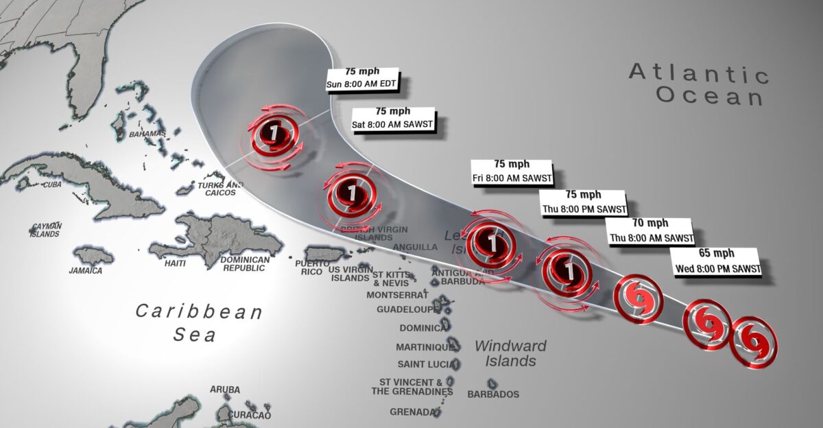
By midweek, Jerry’s wind field spread over an area more than 170 miles wide. Meteorologists clocked the winds between 60 and 65 mph, and the storm moved forward at nearly 23 mph, making it one of the fastest systems to cross the central Atlantic that season.
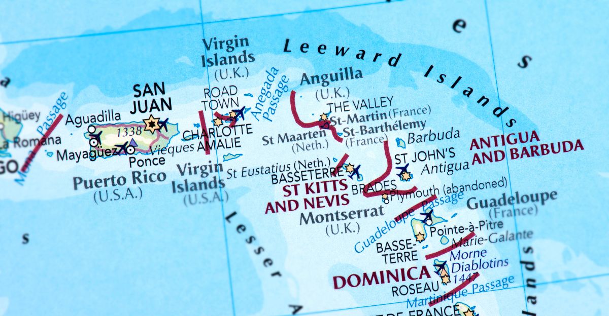
Such speed reduced the time available for communities to prepare. Weather alerts and warnings spread across at-risk islands, including those in the Leeward and Virgin chains.
As meteorologists compared new models, they debated one question: Could Jerry strengthen into a hurricane?
Storm Origins
Jerry became the tenth named storm of the 2025 Atlantic hurricane season on October 7. The National Hurricane Center gave it a name after spotting a cluster of thunderstorms that started rotating around a developing low-pressure zone deep in the central Atlantic.
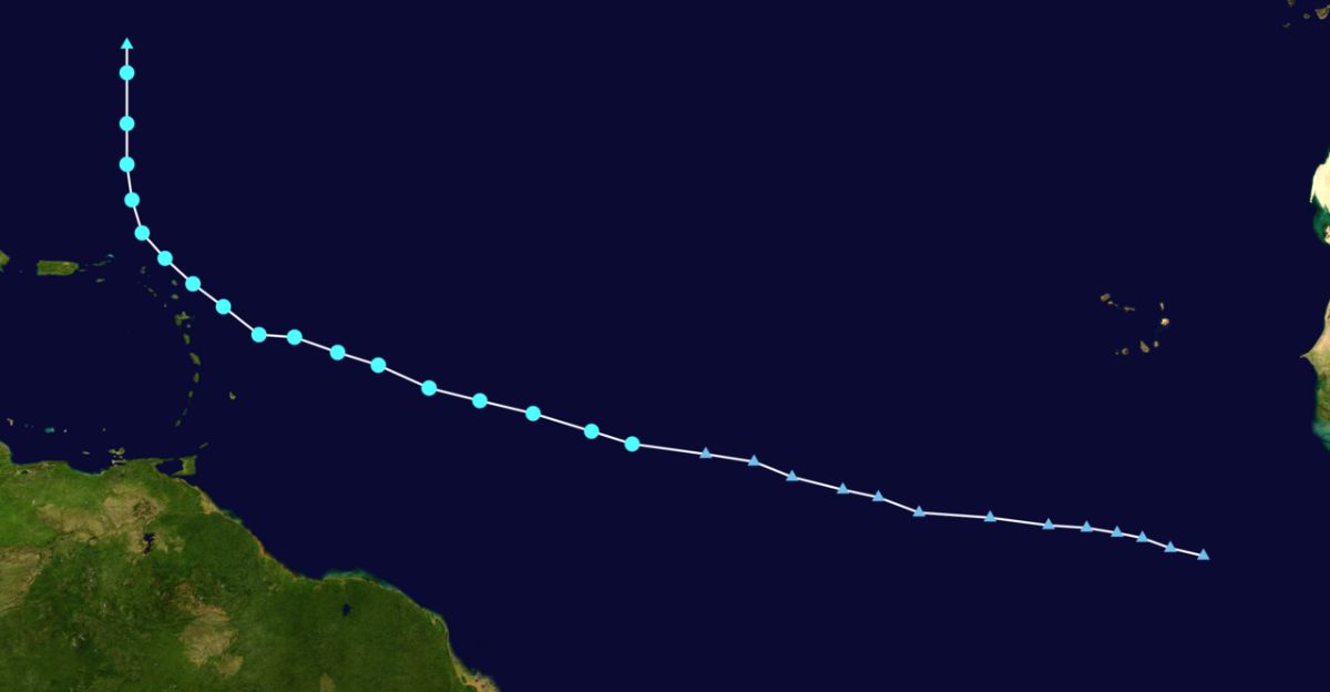
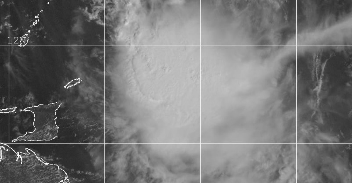
Located near 11.5°N, 44.6°W which is almost midway between Africa and the Caribbean, Jerry was still far out to sea, but it was already showing signs of rapid organization.
Satellite images revealed a growing system shaped by warm ocean waters and an active atmosphere, signaling it could intensify soon.
Pressure Builds
As Jerry moved northwest, strong winds high up in the atmosphere pushed against it. These upper-level winds, blowing from the northwest, began ripping the storm apart and made it hard for Jerry to stay organized.
Instead of forming a neat, circular shape, parts of the storm were pulled in different directions. Meteorologist Dr. Papin of the National Hurricane Center explained that Jerry was “struggling against unfavorable wind shear.”
Even so, the system pushed forward and held onto strength, maintaining winds near 60 mph. The storm’s persistence prompted forecasters to extend warnings for islands within its projected path.
The storm’s uneven shape left experts wondering whether it could overcome a disorganized core to intensify further.
Intensifying Threat
On October 8, official National Hurricane Center advisories confirmed Jerry’s top sustained winds were holding at 60 mph.
The storm’s center moved within 65 miles of the northern Leeward Islands, putting tens of thousands of residents under threat. Both NHC and AccuWeather reports projected that Jerry could strengthen once it passed through zones of lighter wind shear.
Officials urged communities along the projected path to monitor updates as forecasts pointed toward further development. At that point, Jerry had fully captured international attention.
Island Impact
Rain and flooding concerns grew as Jerry moved closer to the Leeward and Virgin Islands. Forecasts indicated 4–6 inches of rain could fall on Barbuda, with nearby areas expected to get about half that.
Flash flooding and dangerous surf conditions forced local governments to close beaches and issue red-flag warnings.
Officials put emergency crews on standby for possible rescues and told residents to remain indoors. For many in the Caribbean, Jerry served as an early-season reminder of how quickly tropical weather can turn threatening.
Human Stories
Residents shared their fear and frustration as conditions worsened. In Antigua and Barbuda, people described how the atmosphere changed from calm to chaos within hours.
Heavy waves crushed coastal roads and shut down ferry operations. Wind gusts rattled windows, tore off signs, and forced travelers to seek immediate shelter. In St. Kitts and Nevis, high winds caused power outages and brief flight delays.
Emergency shelters filled up quickly overnight as Jerry’s wind field stretched far wider than expected, catching many off guard with its swiftness and intensity.
Forecast Tensions

Forecast models began to predict that Jerry could near hurricane strength as early as the weekend. Warnings were prepared in advance, in case the storm crossed the 74 mph threshold.
However, growth was far from certain. Some experts noted lingering wind shear that might stop Jerry from organizing efficiently.
The atmosphere surrounding the storm made the forecast tricky, conditions favored intensification at low levels, yet upper winds could still tear the storm apart. The debate captured public attention as scientists admitted the situation could shift quickly.
Model Uncertainty

To improve their accuracy, meteorologists combined insights from human experts with new machine learning models, including DeepMind’s forecasting platform.
While computers showed possible hurricane-level strength within two to four days, forecasters remained cautious in official advisories. The collaboration between skilled forecasters and artificial intelligence produced a balanced view, acknowledging the potential while avoiding overconfidence.
This teamwork allowed the National Hurricane Center to deliver the most realistic warnings possible as Jerry continued its unpredictable march northwest.
Collateral Patterns
Jerry’s storm system was uneven, so its strongest rain and winds happened far from its center—mainly to the south and east. Some islands that believed they were outside the danger zone still faced heavy flooding, large waves, and damaged coastlines.
This showed a key point about storm forecasts: the “cone of uncertainty” only indicates where the center of the storm might go, not where the worst weather will occur.
Because tropical storms spread their effects over hundreds of miles, even places outside the cone can experience severe damage.
Local Frustration

Emergency officials across the Leeward Islands and Puerto Rico voiced concerns about communication during the storm.
Many residents misunderstood the risk zone maps, thinking they were safe because they weren’t directly in the cone. In reality, Jerry’s large circulation affected a much broader area. This confusion (nicknamed “cone confusion”) remains a common challenge during hurricane season.
Disaster managers vowed to simplify public messaging in future storms to ensure communities understand that tropical hazards respect no boundaries.
Authority Shifts
While the National Hurricane Center remained the central authority, local Caribbean organizations stepped up to fill communication gaps.
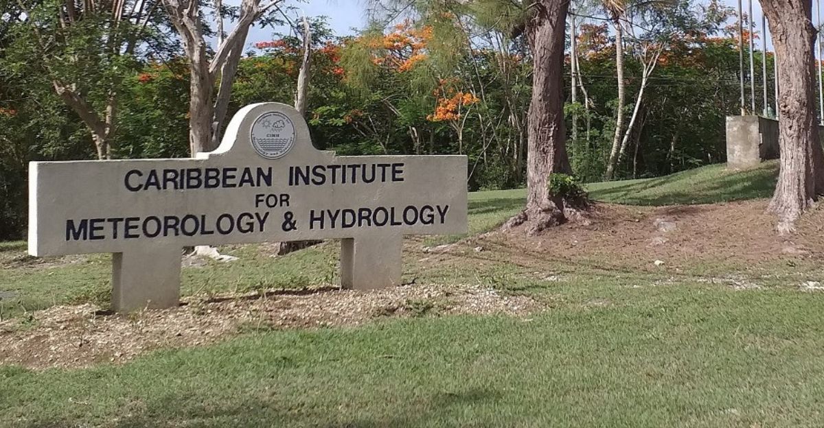
The Caribbean Institute for Meteorology and Hydrology (CIMH) joined forces with regional weather offices to provide local-language updates, helping reach areas with limited internet access.
This cooperation aimed to create a chain of reliable, real-time communication from international meteorological databases down to island-level alerts—a critical improvement for saving lives during fast-moving storms like Jerry.
Adaptive Strategies
Before Tropical Storm Jerry arrived, local leaders in Barbuda and St. Martin took action early. They organized partial evacuations so people could move to safe places like schools, churches, and community centers.
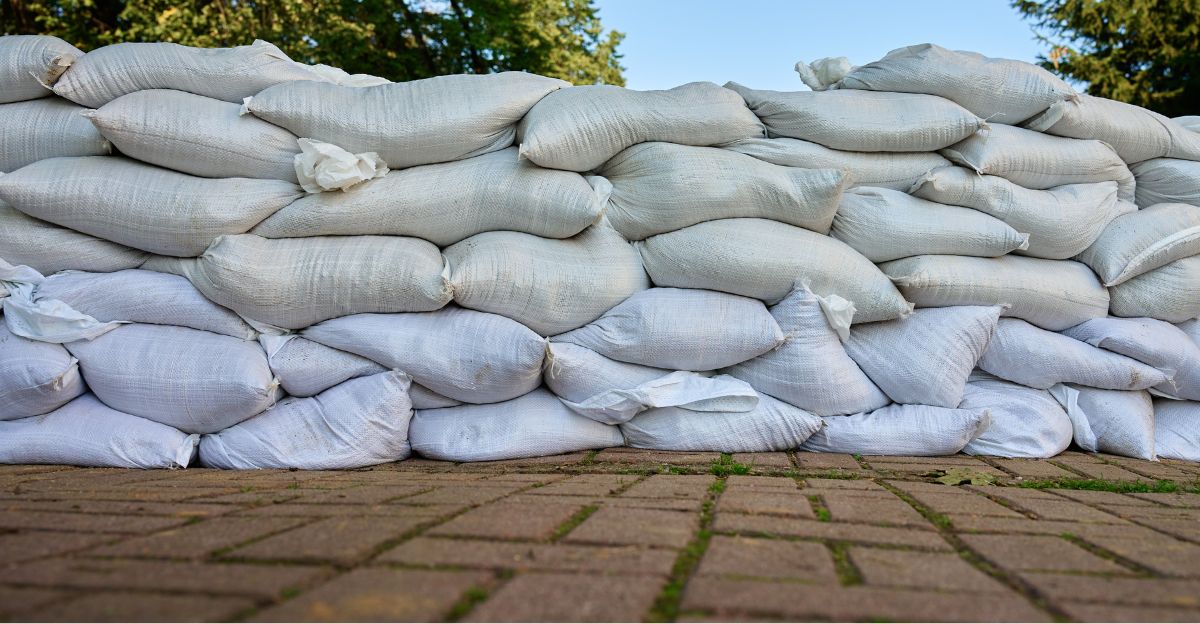
Businesses prepared by covering windows, putting up shutters, and stacking sandbags to protect against flooding.
Social media and radio stations became crucial communication tools. Local radio hosts streamed updates online and shared important information through WhatsApp and live broadcasts.
Because they used both traditional alerts and modern digital platforms, communities were able to stay connected and respond quickly as the storm’s path shifted with little warning.
Expert Doubt

After the storm moved on, weather experts reviewed what they got right and what went wrong.
Dr. Alan Sanders told Newsweek that powerful upper-level winds, known as wind shear, kept Jerry from becoming a full hurricane. These winds pulled the storm apart before it could fully organize.
His explanation showed that even with all the technology meteorologists have, predicting how storms behave in fast-changing conditions is still difficult.
The experts agreed that while today’s forecasting tools help give earlier warnings, the atmosphere is too complex to predict perfectly.
Looking Ahead

As the 2025 hurricane season edges toward its end, forecasters continue watching the Atlantic closely.
The ocean remains warm, and atmospheric patterns suggest more storms could appear before the year is over.
For people across coastal regions, Jerry stands as a reminder that the next big storm could already be forming—and that readiness is the best defense against nature’s growing unpredictability.